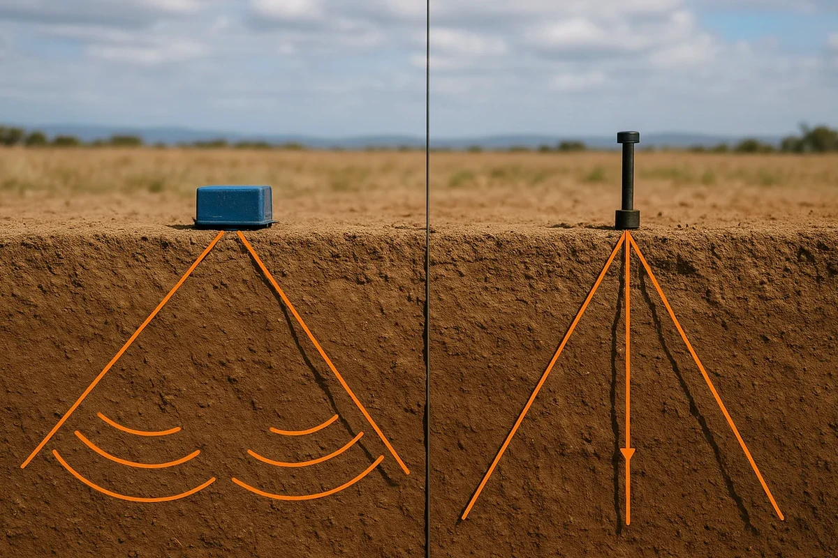
Geophysics in Arlington, Virginia, encompasses a suite of non-invasive subsurface investigation techniques that allow engineers, environmental consultants, and developers to visualize what lies beneath the ground without breaking soil. This category covers methods like ground penetrating radar surveys, electromagnetic conductivity mapping, and seismic assessments. Given Arlington's dense urban fabric, historic infrastructure, and complex regulatory environment, geophysical surveys are not merely a preliminary step but a critical risk-management tool that prevents costly clashes with unknown utilities, unmapped storage tanks, and unstable geological features before excavation or foundation design begins.
Arlington sits at the boundary between the Piedmont Plateau and the Atlantic Coastal Plain, a geological transition zone characterized by deep weathering of metamorphic bedrock and overlying layers of unconsolidated sediments. The local stratigraphy typically features saprolite—a soft, clay-rich decomposed rock—overlying competent schist and gneiss, with depths to bedrock varying dramatically across short distances. This variability creates a challenging environment for construction, as differential settlement and abrupt refusal during pile driving are common risks. Geophysical methods, particularly seismic refraction profiling, are essential for mapping the top of competent rock and identifying fracture zones or voids within the weathered profile that could compromise foundation integrity.
Any geophysical investigation performed in Arlington County must align with standards set by the Virginia Department of Environmental Quality (DEQ) and the Virginia Professional Engineers and Land Surveyors Board, particularly when the data informs environmental remediation or public safety decisions. The American Society for Testing and Materials (ASTM) International provides the primary technical guidelines, with ASTM D6432 for GPR and ASTM D5777 for seismic refraction being the most frequently cited standards. Additionally, local ordinances under the Arlington County Code, specifically Chapter 26 (Utilities), mandate precise private utility locating via geophysical means before any public right-of-way excavation, reinforcing the regulatory necessity of these services.
Project types requiring geophysical surveys in Arlington range from high-rise commercial developments in Rosslyn and Crystal City to infrastructure renewal along the Rosslyn-Ballston corridor. Environmental site assessments for brownfield redevelopment frequently employ electromagnetic surveys to delineate buried metallic debris, while historic preservation efforts on Civil War-era sites use GPR to map unmarked graves and structural remnants without disturbance. Critical transportation projects, such as the expansion of Arlington National Cemetery's interment capacity or the ongoing work for the Potomac Yard Metro station, rely heavily on integrated geophysical programs combining GPR survey data with seismic tomography to de-risk subsurface construction in sensitive settings.
The primary purpose is to non-invasively characterize subsurface conditions to mitigate risks associated with unknown utilities, variable bedrock depth, and potential soil contamination before construction begins. In Arlington's dense urban setting, this prevents costly utility strikes, ensures proper foundation design on the irregular Piedmont-Coastal Plain geology, and satisfies local utility marking ordinances required for right-of-way excavation permits.
Arlington's transition zone geology, featuring deep saprolitic weathering over competent metamorphic rock, creates a highly variable subsurface. Seismic refraction is often preferred for mapping the top of bedrock due to the strong velocity contrast between soil and stone, while ground penetrating radar may struggle in conductive, clay-rich saprolite. A desktop geological review is always performed first to select the optimal geophysical technique for the specific site conditions.
Geophysical investigations are governed by technical standards from ASTM International, such as ASTM D6432 for GPR and D5777 for seismic refraction. The Virginia Professional Engineers and Land Surveyors Board regulates the practice, requiring that data interpretation affecting public safety be overseen by a licensed professional. Locally, Arlington County Code Chapter 26 requires geophysical utility locating before any excavation within the public right-of-way.
Geophysical methods do not directly measure chemical contamination but are crucial for mapping the pathways and extents of contaminant plumes. Electromagnetic and resistivity surveys map conductive leachate plumes, while GPR can delineate the boundaries of underground storage tanks and buried waste. This indirect mapping guides the placement of direct-push soil borings and monitoring wells, making the overall site assessment process more accurate and cost-effective.